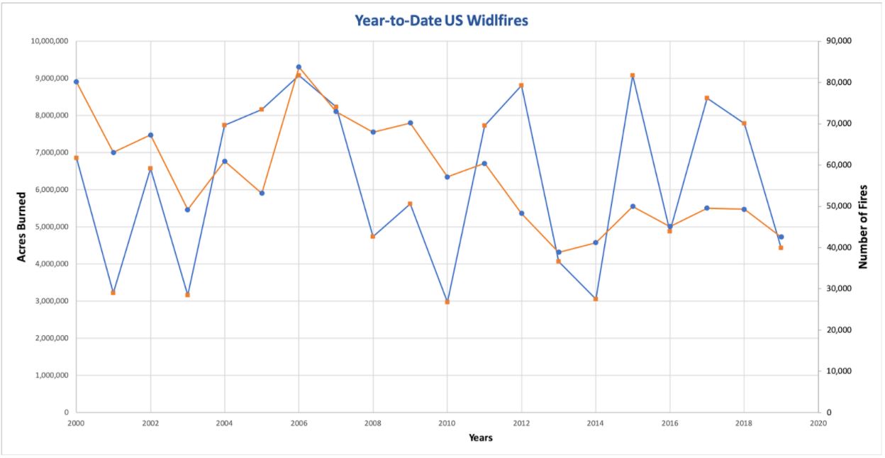
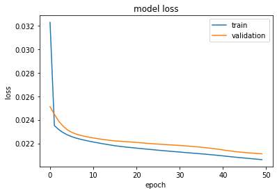
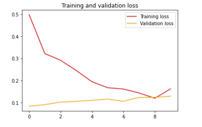
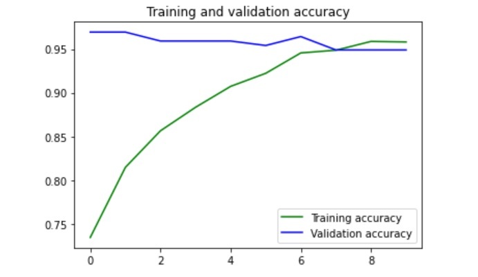
Every year, almost 6 million acres of land is burnt due to wildfires with more than 50,000 such wildfire occurrences on average within the United States alone. (Ref). Though organizations such as Fire Information for Resource Management System FIRMS maintains daily and historical dataset of the geographic and temporal locations of wildfire, a centralized system for the dissemination of this information to all stakeholders is missing.

Team Oozma Kappa, therefore proposes an Information and Communications Technology ICT-based service backed by hybrid-modeling approach that can help stakeholders take necessary actions based on following approaches:
Our state of the art model follows a two-fold multi-modal approach that includes:


- Our Temporal model has been extensively trained on 8806 temporal records from the MODIS C6 Active Fire Data spanning from 09/26/2020 to 10/03/2020 with following feature-set.

- Our Spatial model has been trained on 2000 labeled street images with fire and neutral (non-fire) visuals acquired from DeepQuest AI image repositories.
MSE of the RNN model on train set is 0.0206 and on validation set is 0.0211, as we normalized the confidence value from 0 to 1.

Our CNN model achieves 94% validation accuracy with only 14.5% validation loss.

